Boundary and Topographic Surveying
in Crivitz, WI
At Rob Kamps Land Surveying – Jeff Lieuwen, PLS, we take pride in being Crivitz’s trusted source for professional land surveying services. For more than 40 years, our family-owned and operated business has been helping homeowners, developers, contractors, and municipalities across Northeastern Wisconsin with accurate, dependable, and timely surveys. We also specialize in boundary surveying and topographic surveying, along with a full range of related services designed to support land development, property ownership, and construction projects throughout Marinette County and beyond.
Our work is truly built on precision, experience, and integrity. So whether you’re buying property, building a home, or planning a large-scale development, our team provides the detailed
information you need to make confident decisions.
Featured Reviews
“I worked with Jeff Kamps for a survey on our land and I knew it was going to be quite the task! Jeff is awesome. He kept me apprised of every point along the project. He was patient in our conversations and always made sure that I understood the entire process and answered all of my questions very thoroughly. They delivered way above expectations. Bonus! I highly recommend Rob Kamps to anyone looking for survey needs!! Thank you Jeff and Rob Kamps Surveying Co. !!!”
– Miss Moto
“We hit a roadblock on a property sale due to county survey records being off. We needed a survey done ASAP. Jeff was amazing and got it done even sooner than promised. He even met with us on a Saturday to hand deliver the results. I can’t say thank you enough for taking this stress off our plates and getting our sale moving again.”
– Monica Wiegand
Local Expertise, Proven Experience
Crivitz is known for its scenic landscapes; rolling hills, forested land, winding rivers, and lakes that make this part of Wisconsin one of the most beautiful areas in the state. Those same natural features that make the region so desirable also make accurate surveying essential. From uneven terrain to floodplain boundaries near the Menominee River and Peshtigo River, a precise survey helps property owners and builders understand the land and its limitations.
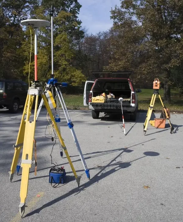
With over four decades of experience working in the unique geography of Northern Wisconsin, we understand the area’s soil conditions, elevation changes, and local regulations. Our surveying team uses modern GPS and total station technology to ensure precise measurements, while our knowledge of local property records and zoning laws helps streamline your project from start to finish.
Boundary Surveys:
Defining Property with Accuracy
A boundary survey is one of the most important services we offer. It clearly establishes the corners and property lines of your land, helping prevent disputes with neighbors and ensuring that any improvements, such as fences, driveways, or buildings, are placed correctly.
Our boundary surveys are performed according to Wisconsin state standards and are ideal for:
- Homeowners planning new construction or improvements
- Buyers and sellers needing accurate property information before closing
- Landowners resolving property line disputes
- Developers preparing for subdivision or site development
We combine field measurements, deed research, and existing plat data to produce a complete, legally defensible record of your property’s boundaries. When you work with us, you can count on clarity and confidence in your property’s dimensions and ownership limits.
Topographic Surveying:
Understanding the Land’s Surface
Topographic surveying provides the foundation for design and construction. These surveys capture the natural and man-made features of your property, including elevation changes, trees, structures, drainage patterns, and contours, to give engineers, architects, and builders a clear picture of the site.
Our topographic surveys are often used for:
- Residential and commercial site planning
- Drainage and grading design
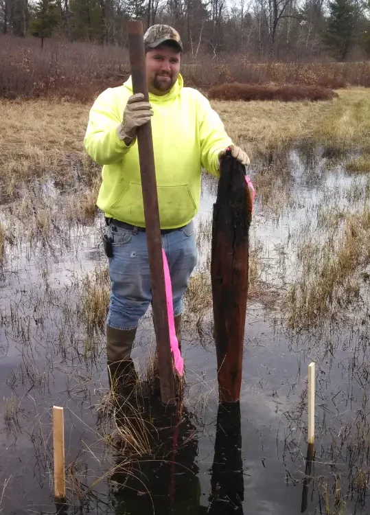
- Wetland limitations
- Road and utility improvements
- Environmental and floodplain assessments
Whether you’re developing new property near Lake Noquebay or improving existing land within Crivitz or the surrounding communities, our topographic data helps ensure your project is designed and built correctly from the ground up.
Comprehensive Surveying Services
While boundary, development, and topographic surveying are our primary specialties, Rob Kamps Land Surveying – Jeff Lieuwen, PLS offers a complete range of surveying and mapping services for both residential and commercial clients.
Our capabilities include:
- ALTA/NSPS Land Title Surveys
- Subdivision Surveying and Planning
- Construction Staking and Site Layout
- Floodplain Surveys (LOMA/LOMC)
- Elevation Certificates
- Lot Surveys
- Certified Surveys (CSM)
- As-Built Surveys
- Wetland Delineation
- Boundary Line Adjustments
- Hydrographic Surveys
- Right-of-Way and Easement Surveys
- Geodetic and GPS Surveying
- Environmental and Site Planning Surveys
We tailor each project to your specific needs, whether you’re managing a small parcel of residential land or coordinating a large-scale commercial development. Every survey is performed with care, accuracy, and attention to detail — because we know that even the smallest error can have a major impact down the line.
Why Clients Across Wisconsin Choose Us
Our reputation for quality service comes from decades of dedication to our clients and our craft. As a family-owned business, we treat every project as if it were our own, combining personal attention with professional precision.
When you choose Rob Kamps Land Surveying – Jeff Lieuwen, PLS, you can expect:
- Over 40 years of experience in Wisconsin surveying and mapping
- Friendly, responsive service from a locally owned team
- Accurate, detailed results delivered on time and within budget
- Modern surveying technology for precise data collection and reporting
- Deep knowledge of Marinette County property records and regulations
We believe that communication is key. Our team takes the time to explain the process, answer your questions, and ensure you understand every step of the project. Whether it’s a first-time homeowner or a seasoned developer, we make sure every client receives clear, comprehensive results.
Supporting Local Development in Crivitz and Beyond
From small rural properties to lakeside developments and municipal projects, our work supports the continued growth and stability of the Crivitz area. We regularly assist homeowners throughout Marinette AND Oconto County, as well as clients in nearby communities such as Wausaukee, Coleman, Peshtigo, and Oconto.
We take pride in helping Wisconsin property owners make informed decisions about their land. Our surveys serve as the foundation for accurate title transfers, smart development, and long-term land stewardship.
Areas Served
Brown County, WI | Crivitz, WI | De Pere, WI | De Pere, WI | Florence County, WI | Forest County, WI | Green Bay, WI | Green Bay, WI | Langlade County, WI | Marinette, WI | Marinette, WI | Oneida County, WI | Outagamie County, WI | Peshtigo, WI | Peshtigo, WI | Shawano, WI | Shawano, WI | Shawano County, WI | Vilas County, WI
Frequently Asked Questions
The Trusted Name in Wisconsin Land Surveying
At Rob Kamps Land Surveying – Jeff Lieuwen, PLS, we combine experience, technology, and personal service to deliver surveys you can rely on. Whether you need a boundary survey, topographic mapping, or a detailed site plan, our family-owned team brings more than four decades of local expertise to every project.
We’re also proud to serve the people of Marinette County and the surrounding region with honesty, accuracy, and professionalism. So if you need reliable land surveying services from a team that truly understands the land and the community, just simply contact us today. Let us help you build with confidence, backed by the precision and care that only experience can provide.